
Truck parking data for State Freight Plan updates
Federal law requires it. We supply it.
49 U.S.C. § 70202: every State Freight Plan must include a commercial motor vehicle parking assessment.
The assessment is mandatory, but a facility list alone will not survive review. You need supply, demand, and shortage evidence.
The gap
Four questions a static inventory cannot answer
- Is the inventory current and accurate?
- Where and when does parking fill up?
- Where do shortages repeat?
- How fast will demand grow here?
Beyond the assessment
We map the shortage, and the way out.
The § 70202 assessment shows where parking is short. The harder question is where new capacity can actually go. Expanding at a known hotspot is usually blocked.
Thin revenue model
Federal limits on commercial activity at Interstate rest areas leave few ways to fund M&O.
Costly land
Right-of-way near saturated corridors is usually the most expensive land around.
Local opposition
The closer a site sits to development, the harder the fight.
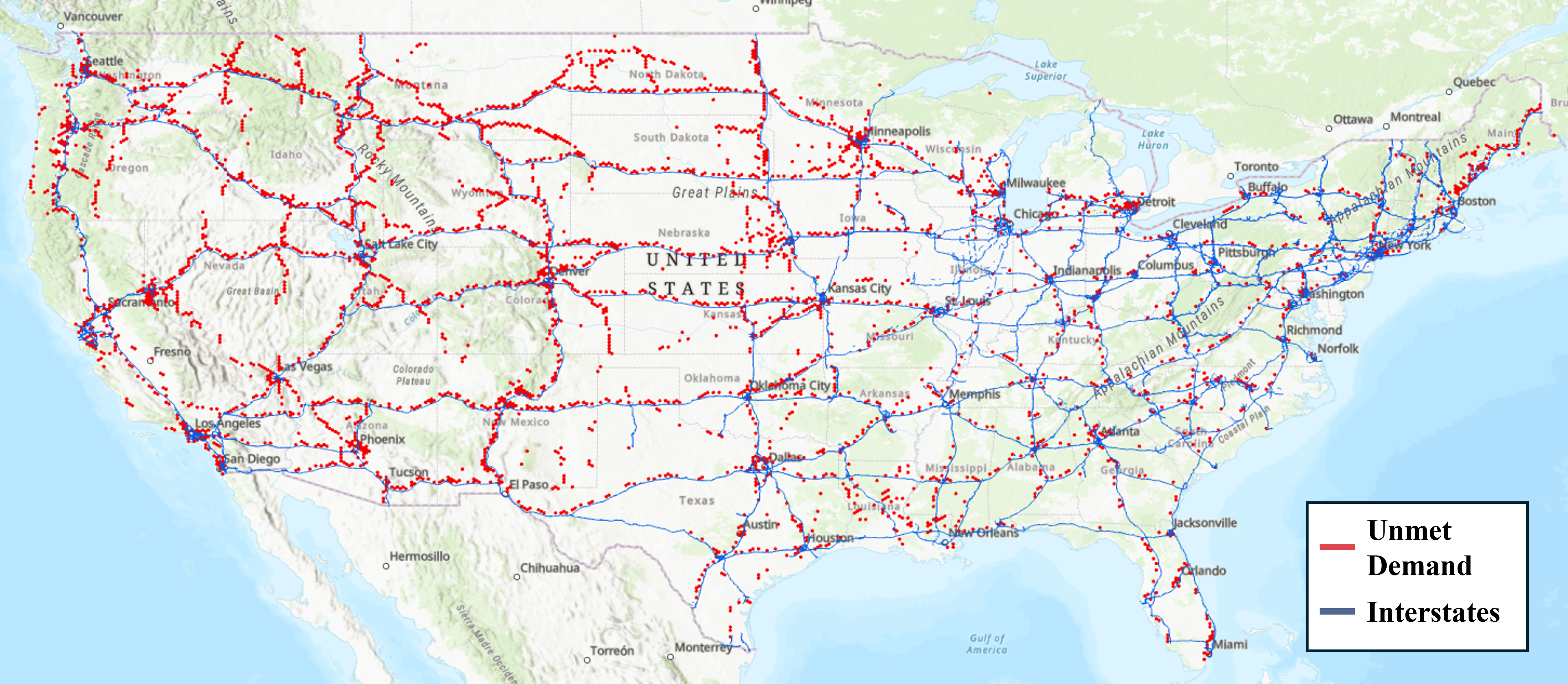
Our demand model estimates demand independently of existing supply, so it also finds candidate zones: grids with expected demand and no facility today. Texas has 609. Illinois has 220. Intersect them with your ROW inventory or surplus-property list, and you have a parcel-level shortlist.
What you get
Six outputs for the assessment chapter
- 01
Verified inventory
Current, geolocated public and private facilities, organized for planning use.
- 02
Availability data
Observed patterns showing where and when supply runs out.
- 03
Shortage analysis
Corridor and facility-level pinpointing of recurring parking pressure.
- 04
Demand forecasting
Future demand estimates, including candidate zones with demand but no facility.
- 05
GIS-ready maps and tables
Structured outputs for maps, summaries, and internal review.
- 06
Methodology notes
Sources, assumptions, and processing steps, documented for technical review.
Comparison
Static list vs. planning data
| Focus | Static inventory | Trucking Lab |
|---|---|---|
| Facility data | Names and addresses, unverified. | Geolocated, structured, planning-ready. |
| Availability | Cannot show when parking fills. | Shows where and when supply runs out. |
| Shortages | Cannot explain recurring pressure. | Pinpoints recurring shortage locations. |
| Future demand | Needs separate analysis. | Forecast built in, with candidate zones. |
| Planning output | More GIS work on your end. | GIS-ready maps, tables, methodology notes. |
Process
Five steps into your Freight Plan
- 01
Update the inventory
Replace stale records with verified, geocoded facilities.
- 02
Review availability
See where and when supply becomes limited.
- 03
Locate shortages
Flag locations with recurring parking pressure.
- 04
Forecast demand
Ground the future-needs discussion in modeled estimates.
- 05
Drop in the outputs
GIS-ready maps, tables, and methodology notes go straight into the plan.
FAQ
Common questions from State DOT teams
What does § 70202 actually require?
Every State Freight Plan must include the most recent commercial motor vehicle parking facilities assessment conducted by the State.
What data supports the assessment?
Facility locations, capacity, availability patterns, shortage locations, and demand forecasts.
Why isn’t a static inventory enough?
It shows where facilities are. It cannot show when they fill, where pressure repeats, or how demand will change.
Can the data find new candidate locations, not just document shortages?
Yes. Demand is modeled independently of supply, so the analysis surfaces candidate zones: areas with expected demand and no facility today. That is where overflow can go when hotspot expansion is blocked by ROW cost, M&O burden, or local opposition.
Can the analysis be customized?
Yes. Statewide, corridor, regional, or facility level.
Built by Troy Choi, Ph.D., P.E. Freight planning, truck parking, and transportation safety.
Updating a State Freight Plan?
Tell us the state and timeline. We will show you what the assessment package looks like.